Share:
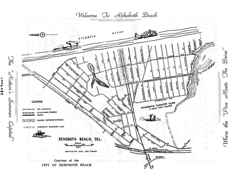
The central, incorporated core of Rehoboth Beach in 1950
August 2, 2016
This map from the City of Rehoboth Beach shows the layout of the city in 1950. Then, as now, the beach is the widest part of the city. Anyone who was on the sand this past weekend - during the peak of the summer of 2016 - knows there was little room left for anyone else from one end of the Boardwalk to the other. Clearly too, the central business district has expanded greatly since this promotional map was created, and Rehoboth Beach Country Club has long since moved out of town.


