Share:
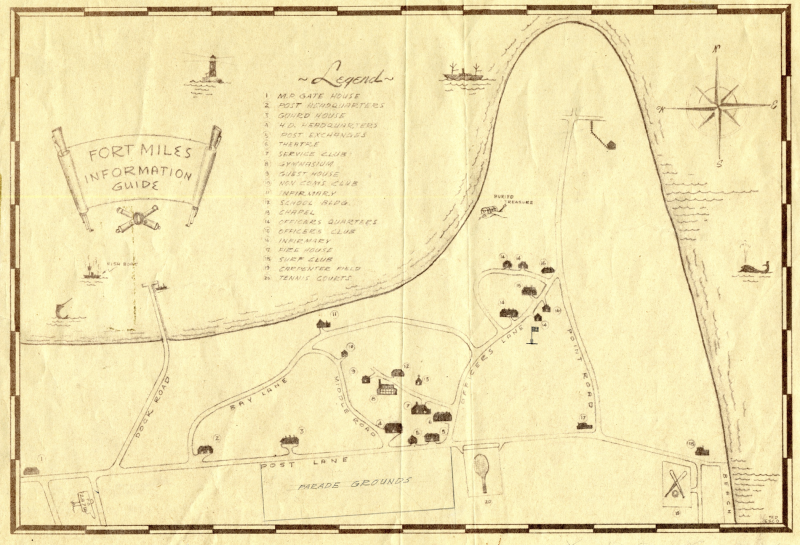
An informational map of Fort Miles
December 17, 2024
This is an informational map of Fort Miles in what is today’s Cape Henlopen State Park. As most know, with war looming in Europe, military officials established Fort Miles in 1941 to defend the mouth of the Delaware Bay. The fort remained in operation in some form until 1991, when it was fully decommissioned.
The map reveals that Fort Miles was basically its own little town in Lewes. It had a schoolhouse, theater, fire house, surf club, baseball field, tennis court, chapel and gymnasium. Many of the buildings still exist in some form, while others have disappeared in the decades since Fort Miles closed.


