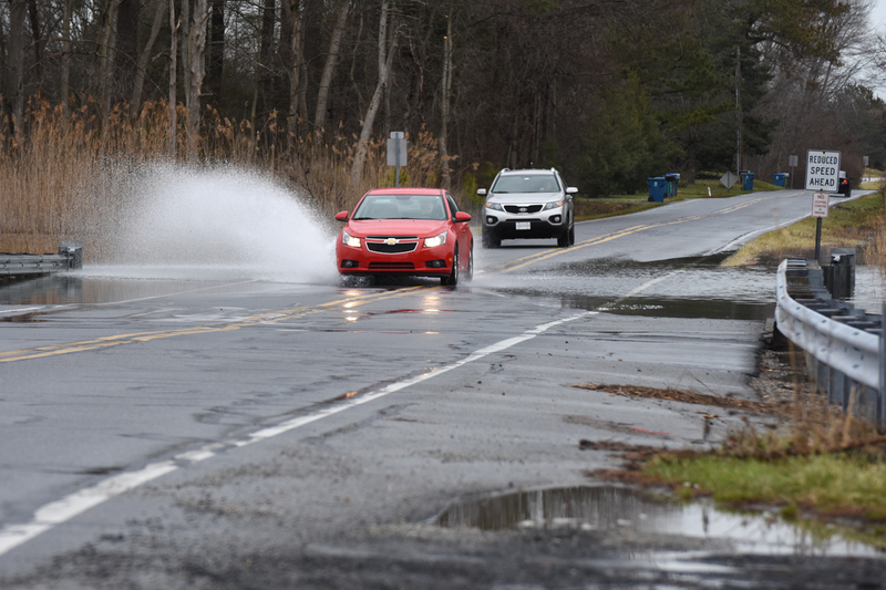
Flooding is nothing new for the residents of Lewes.
But with Hurricane Sandy in 2012 and Winter Storm Jonas earlier this year, the scale of flooding during big storms has raised some eyebrows. Add sea-level rise into the mix, and future scenarios can be alarming.
Lewes officials are beginning to envision some of the what-if scenarios for flooding over the next couple of decades and they are taking steps to mitigate their impact.
Lewes used a $10,000 grant from Delaware Coastal Programs to evaluate the vulnerability of the city’s evacuation routes and critical infrastructure. Charlie O’Donnell, an engineer with George, Miles and Buhr, presented the results of the study at council’s Feb. 8 meeting, offering recommendations for officials to consider.
The study identified 17 areas to assess vulnerability. After looking at a variety of factors, such as a roadway’s importance to evacuation or the necessity of infrastructure to remain operational, the areas were ranked. Top priority, O’Donnell said, is an electrical substation near Cape Henlopen High School that serves as a switch between Delmarva Power and the Board of Public Works. Receiving the second-highest priority on GMB’s list is the Canary Creek bridge on New Road, an area that often floods during storms. Also receiving high priority were the beachside stretch of Savannah Road, Cape Henlopen Drive at Freeman Highway and the west end of Cedar Street.
Mayor Ted Becker said the city has already been in contact with the congressional delegation and Department of Transportation Secretary Jennifer Cohan about New Road and Savannah Road, as both roadways are state owned and maintained.
The data O’Donnell used in his evaluation comes from a 2009 Department of Natural Resources and Environmental Control study that formulated sea-level rise scenarios through 2100. Those scenarios represented a worst-case, intermediate, low and stable scenario.
Danielle Swallow, a planner with Delaware Coastal Programs, said DNREC’s scenarios are based on global modeling from scientists all over the world.
“They reach consensus and then a committee DNREC formed takes a look at those global models and adjust them for local conditions,” she said.
Sea-level rise in Delaware is accelerated when compared to different areas, she said, because the state experiences a lot of land subsidence, or land sinking.
Swallow said DNREC is in the process of revising its sea-level rise scenarios and they will likely be released later this year. She said she does not expect to see a major fluctuation in the projections.
“There is some level of uncertainty,” she said. “These are just projections; they’re not predictions.”
To better plan for sea-level rise and larger flooding events, council accepted O’Donnell’s recommendations to establish a 25-year scenario for capital project planning and a 40-year time frame for land-use planning.
In selecting the intermediate sea-level rise scenario, city officials can use those projections when making decisions. Based on DNREC’s intermediate scenario, sea levels are expected to rise .7 feet by 2041 and 1.2 feet by 2055.
“Currently, we don’t have anything [to base decisions on],” Becker said. “So this is a start.”
O’Donnell said there are two ways to plan for the future – mitigation and adaptation. Lewes has already tackled many mitigation initiatives, such as building the wastewater treatment plant to the 100-year flood elevation and choosing porous pavement when repaving Bay Avenue. He said future decisions can now be made with the new projections in mind. In terms of adaptation, he said, city officials should consider updating the emergency evacuation plan and evacuation time frames.
Nick Roth is the news editor. He has been with the Cape Gazette since 2012, previously covering town beats in Milton and Lewes. In addition to serving on the editorial board and handling page layout, Nick is responsible for the weekly Delaware History in Photographs feature and enjoys writing stories about the Cape Region’s history. Prior to the Cape Gazette, Nick worked for the Delmarva Media Group, including the Delaware Wave, Delaware Coast Press and Salisbury Daily Times. He also contributed to The News Journal. Originally from Boyertown, Pa., Nick attended Shippensburg University in central Pennsylvania, graduating in 2007 with a bachelor’s degree in journalism. He’s won several MDDC awards during his career for both writing and photography. In his free time, he enjoys golfing, going to the beach with his family and cheering for Philadelphia sports teams.


