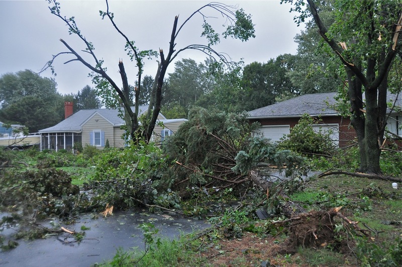
The National Weather Service confirmed Aug. 31 that a tornado touched down in Lewes as Hurricane Irene moved through the region.
Officials said a tornado with winds reaching 95 mph hit at 6:38 p.m. Aug. 27 and traveled three-quarters of a mile. The weather service estimates the tornado was as much as 80 yards wide.
"The tornado touched down near the eastern end of Tradewinds Lane, then moved in a westerly direction along Tradewinds Lane, crossing Road 269A before lifting at Crab Apple Lane" in Nassau Station, the report states.
A home in Nassau Station was the hardest hit. Winds took off most of the roof and garage and damaged the outer walls. About 50 other homes along the twister's route sustained minor damage, according to Sussex County officials. The tornado winds sheared off trees starting along Donovan's Road, traveled west through Tradewinds Estates and then struck the home in Nassau Station.
Meteorologists use the Enhanced Fujita Scale to classify tornadoes, based on wind speed and the damage the winds cause. The tornado in Lewes was rated an F1 tornado, meaning it has winds of 86 to 110 mph.
If Hurricane Irene had brought sustained winds of 95 mph, matching the winds of the tornado, National Weather Service meteorologist Lee Robertson said damage across the area could have been similar to what the homes within the tornado's path incurred.
"I imagine it would be wide spread," he said.
According to the National Weather Service, winds in Lewes reached 66 mph at 6:06 p.m. Aug. 27. The National Hurricane Center categorizes a Category 1 hurricane as one with sustained winds of at least 74 mph.
"There is some debate as to what strength the storm was," said National Weather Service meteorologist Walter Drag. "It may be downgraded to a strong tropical storm, but for now it is a Category 1."
Drag said meteorologists are in the process of compiling weather statistics and sending them to the National Hurricane Center, where the final determination of Hurricane Irene's strength will be made.
Melissa Steele is a staff writer covering the state Legislature, government and police. Her newspaper career spans more than 30 years and includes working for the Delaware State News, Burlington County Times, The News Journal, Dover Post and Milford Beacon before coming to the Cape Gazette in 2012. Her work has received numerous awards, most notably a Pulitzer Prize-adjudicated investigative piece, and a runner-up for the MDDC James S. Keat Freedom of Information Award.


