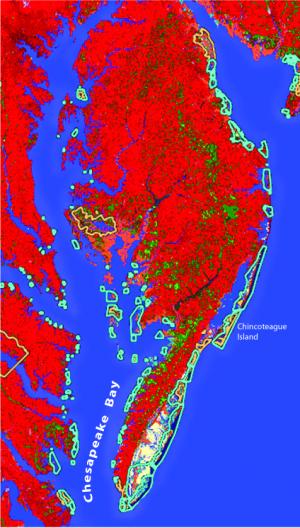
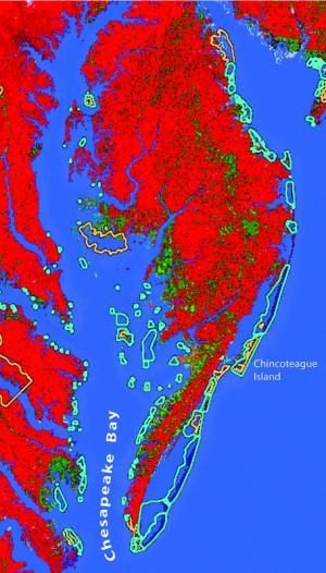
Online maps track sea-level rise
New interactive maps allow viewers to see how sea-level rise will affect their properties.
The maps, available online, allow residents to type in an address and get an idea of how that property will be affected by sea level rise through the year 2100.
“These new models are a big deal in my office because we get a lot of questions about coastal habitat concerns,” said Leopoldo Miranda-Castro, supervisor and website manager for the new maps, based at the Chesapeake Bay Field Office in Annapolis. “Many residents contact us wanting to find out more information about what sea-level rise will do to their properties, so now we can refer them to this website.”
The new model, available through the U.S. Fish & Wildlife Service, is known as the Sea Level Affecting Marshes Model (SLAMM).
“When I first saw the SLAMM model in Washington, D.C., I asked if we could use them. The information was readily out there, we just made it available to everybody,” Miranda-Castro said. “This data used to be just for scientists, but now any resident can use it with internet access.”
Degrees of information
In the Cape Region, residents can now see how sea-level rise will affect beaches. When logging into the system, users enter a specific address or a town name. The system then shows two maps. The first map shows the beach today; the second shows it over a period of years stretching out to 2100.
“This is just another model of many available models, but it gives an idea of what might happen, based on data we have right now,” Miranda-Castro said. “Residents shouldn’t be making lifelong decisions based on one map; but this helps give an idea of something they need to be aware of.”
The U.S. Fish & Wildlife Service first made the maps available several years ago but has recently updated them so they are more user-friendly. They plan to continue updating the maps as new information on sea-level rise becomes available.
Prime Hook residents
Melanie Hoff of Prime Hook took some time to test-drive the SLAMM tool online, but she found it too complicated to use quickly.
“A few residents may invest the time needed to understand what this tool is trying to show,” Hoff said. “A quick 10-minute investment of time is not enough to understand the basic science, how to use the tool, what the displays of one year versus another mean, or to detect the subtle differences between the maps.”
Hoff said she isn’t sure how useful the tool would be to Prime Hook residents interested in finding out how sea-level rise would affect their specific properties.
“The maps are confusing because it is unclear what they are depicting,” Hoff said. “The legend works, but one needs to hunt down the meaning of all the layers to understand the distinctions. For example, I don’t know off-hand the difference between a swamp and a cypress swamp.”
Hoff said she thinks the developers of SLAMM are targeting researchers or college students and not the general public. She said she hopes to see more simple maps in the future.
Website hits
When the maps were first introduced, Miranda-Castro’s office monitored about 1,100 hits to the website each day. The new maps are getting hits in the thousands, he said.
“We get hits from all over the nation and even from other countries,” Miranda-Castro said. “It is likely that average residents are looking at their personal properties because it is a useful tool for them.”
Some worry the information could harm property values in areas estimated to be highly affected by sea-level rise.
“I don’t think they will affect property values. We put a disclaimer in that this should not be used to determine property values. I think the more information the public has, the better decisions they can make,” said Miranda-Castro. “If there are questions, residents should visit the site or give us a call. We would like to hear any ideas that are out there.”
For more information go to http://www.fws.gov/slamm. To access the tool go to http://www.slammview.org


