Residents express concerns over Old Mill Landing

Two subdivisions planned for the Fenwick Island area have ignited an outpouring of protest, but the applicant's attorney says traffic and environmental concerns have been addressed.
Developer Old Mill Bridge LLC has submitted plans for Old Mill Landing South, 156 single-family lots on 145 acres, and Old Mill Landing North, 71 single-family lots on 38 acres, on the north and south sides of Millers Neck Road near Old Mill Bridge Road.
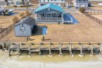
Dirickson Creek, a tributary of Assawoman Bay, borders the southern section of the property.
Opponents voiced their concerns during the Jan. 9 Sussex County Planning and Zoning Commission meeting. During a 3-1/2-hour hearing, the meeting room was filled to capacity, and several attendees were forced to sit in the lobby for part of the meeting.
Commission Chairman Bob Wheatley said while a single presentation was made for both applications, the commission would vote on each as a separate application. At its Jan. 23 meeting, the commission deferred a vote to a future meeting.
Jim Fuqua, the applicant's attorney, said a previous subdivision application, which included the parcels plus additional acreage, received preliminary approval in 2006. Because of an economic recession, The Estuary, 1,052 single-family lots on 737 acres, was not built. It was the 64th subdivision reviewed during that year by the commission. Another plan for a scaled-down subdivision was later submitted and approved.
A plan for Bennett Point, a 273-lot subdivision, was proposed for the parcel in 2014 but was never presented to the commission.
Environmental safeguards in design
Fuqua read a long list of design features aimed at minimizing environmental impact. Those include central sewer service, a minimum of 50-foot buffers from tidal wetlands, a minimum of 25-foot buffers from nontidal wetlands, a 100-foot buffer from the proposed clubhouse and recreation area, a stormwater-wetlands-forest-open-space management plan, and a conservation easement with Sussex County Land Trust to protect 79 acres of the most environmentally sensitive sections of the property.
A 5.25-acre section of farmland would be reforested with more than 600 native trees.
The developer has also proffered a mandatory nutrient/turf management plan to limit the amount of fertilizer spread on lawns.
Ocean Atlantic CEO Preston Schell, the applicant's representative, said a deed restriction would outline enforcement of the plan to the full extent of state law. “It will be very clear and every resident will sign off on it,” he said.
Fuqua said 117 acres – or 62 percent – of the total 183 acres in both subdivisions would be open space.
The attorney said taking the existing farmland out of production and converting it to residential development would reduce pollutants and runoff into Dirickson Creek with a regulated stormwater management system that would treat runoff before discharge.
Ed Launay, the applicant's environmental consultant, said the proposed stormwater management plan would reduce nitrogen release into the soil by 45 percent and phosphorus by 60 percent.
“This should be a model in the Inland Bays watershed for environmental protection features,” Fuqua said.
Action group lists concerns
The Southern Sussex County Community Action Group, composed of 29 communities along Route 54 and Route 20, pointed to concerns for historic sites, increased flooding risk, increased pollution threats to Dirickson Creek and the Inland Bays, and increased traffic creating unsafe road conditions.
Chairwoman Nancy Flacco said, if the projects are approved, the commission should ensure that all mature forests are preserved, and building should be restricted to areas with proper soils to prevent increased pollution and flood risks.
Fuqua took time to address the group's concerns, noting they are legitimate issues. “They are the same concerns recognized and addressed by the applicant in the planning and design of Old Mill Landing,” he said.
He said the required road and intersection work would improve safety on area roads.
“And the applicant shares the same goals as the coalition for minimizing environmental impact from the development. With the conditions and safeguards stated, Old Mill Landing will have significantly less environmental impact than many, if not all, of the 29 existing residential developments in the coalition. In the near future, we hope to be the 30th member of the coalition,” he said.
Residents: Restrict construction area
After nearly two hours of testimony from area residents, Mohammad Akhter, speaking for the group, offered suggestions for the commission to consider. He said residents had met with Schell to express their concerns, including restricting construction in some areas of the property.
“By preserving the hydric soils, trees and Native American sites, Mr. Schell will be able to market the property as a preserve where people will live in harmony with nature,” Akhter said. “This, in our view, will enhance the value of homes in this proposed development and also those in the surrounding communities. This will surely be a win-win situation for all.”
In addition, he said, residents want an updated traffic-impact study.
“The traffic in our area is already terrible, especially in the summer,” he said. “It's hard for the community residents to get to medical care or for emergency services to respond in a timely manner. Adding an additional 800 cars daily to the mix is unwise. We recommend a new traffic-impact study be completed prior to approval.”
DelDOT would require road improvements
Although residents are requesting a new traffic-impact study, state transportation officials said a 2014 study is sufficient. Marc Cote, DelDOT's assistant director of development coordination, said updated traffic counts are included in the study reflecting recent land-use applications.
Included in the study are the following proposed road improvements that would be funded by the developer: realignment to a right angle of Millers Neck Road with Old Mill Bridge Road; Millers Neck Road improved with 11-foot travel lanes and 5-foot shoulders; shared-use path on both roads along the project's frontage; and reconstruction of Old Mill Bridge Road north of Dirickson Creek bridge to north of the frontage limits with 11-foot travel lanes and 5-foot shoulders.
DelDOT would also require the developer to contribute funding to a future traffic signal or roundabout at the Bayard Road-Daisey Road intersection and to a future dual left-turn-lane project from southbound Route 20 to eastbound Route 54.
Native American artifacts found
In the Preliminary Land Use Service report, the State Historical Preservation Office noted there are eight possible archeological sites on the southern section of the parcel. An archeologist hired by the developer is in the process of finishing a survey of the site.
Fuqua said there are no state regulations governing archeological artifacts found on private land, only on state-owned property.
“There is no law requiring a professional survey, but the applicant feels a responsibility that extends beyond the legal requirements,” Fuqua said.
During the hearing, archeologist Edward Otter said so far his investigation has revealed a combination of historic and prehistoric sites on the parcel, possibly dating back as far as 1000 AD.
He said evidence of Lake Woodland Native Americans has been found, including pottery pieces and arrowheads in the eastern and southern sections of the property. He said Native Americans were probably living there in a small permanent settlement.
Otter said he doubted there would be any human remains in burial plots on the parcel because the sandy soil would not preserve the remains over time.
Fuqua said when the survey is complete, a report and artifacts will be offered to the state, and the report will be available to the public.
Dirickson Creek on southern border
A 2017 Delaware Center for the Inland Bays report found that Dirickson Creek suffers from high levels of nitrogen and phosphorus, excessive bacteria and low dissolved oxygen, which worsens upstream.
Dirickson Creek is considered an impaired body of water under the federal Clean Water Act because of excessive nutrient and bacteria levels.
Old Mill Landing South contains 66 acres of wetlands. Buffers of at least 25 feet are proposed by the developer, including a 100-foot setback from the creek.
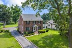
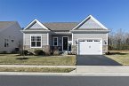
The proposed subdivisions
Proposed amenities include a clubhouse with pool, pickleball courts, tot lots and docks on Dirickson Creek. Built in Old Mill Landing South, amenities would be shared by both developments, which may require a dedicated pedestrian crossing on Millers Neck Road. Two parks, each at 5,000 square feet, would be constructed in Old Mill Landing North. Lots would range from 7,500 square feet to 20,000 square feet, with an average of 9,200 square feet.
Sewer would be provided by Sussex County and water by Artesian Water Co.