Milton planners review town’s future land-use map
The Milton Planning and Zoning Commission decided not to move forward with changes suggested by state planning officials regarding the town’s future land-use map.
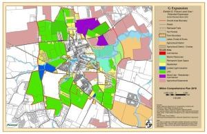
The document serves as a map of where Milton could theoretically be expanded to via annexation. The map extends the potential future borders of Milton as far north as Reynolds Pond Road, as far south as Neptune Road and east up to Beaverdam Creek. The town is required as part of its comprehensive development plan, which is reviewed and ratified by the state, to submit a future land-use or expansion map.
Milton submitted its map as part of its 2023 update to the comprehensive plan. However, state agencies voiced concerns about eight parcels the state wanted to see removed from the map, which was later reduced to three after discussions with town officials. The objections mainly came from the Delaware Department of Transportation regarding the town’s transportation improvement district. Projects within a TID get priority for state funding, and DelDOT and the town have worked on the TID for years. The argument from DelDOT is that if all the parcels are included on the future land-use map, it would mean the TID would need to be reconfigured to include all those parcels.
At planning and zoning’s March 18 meeting, Project Coordinator Tom Quass said the owners of the properties still in dispute have all asked to be included in the future land-use map. The commission decided no changes should be made.
As one example, Commissioner George Cardwell mentioned how Sam Lucas Road is already a major route for trucks coming in and around Milton, and development is only going to expand out to that area. Why shouldn’t the town have a say in what kind of development goes there? he said.
“The state’s not thinking through it,” he said.
Commissioner Maurice McGrath said, “I can’t understand why they wouldn’t want us to put this on paper. There’s no movement at this time, [so] why not just allow us to have it there?”
Colby Cox, developer of the Granary at Draper Farm development, also recommended the town stand its ground.
“It allows the town, and the utility companies like Artesian, to plan five, seven, 10 years from now,” Cox said. “We end up in a situation that often happens where we don’t want these properties developed in the county because then we have control over them. We want to make sure that something developed right on the boundary of the town is part of the town because they’re going to be using all the town’s resources ... This is your town. This is your future. It's not theirs.”
Ultimately, the commission decided to recommend in an advisory report that town council not change the map. The commission also put in its report that the map will be looked at again during the town’s upcoming review of the comprehensive development plan due in 2028.


