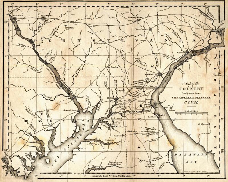
An 1841 map showing Chesapeake and Delaware Canal
The Chesapeake and Delaware Canal is one of the busiest canals in the world. This 1841 map shows the route of the canal in its very earliest days, as well as the surrounding area of Delaware, Maryland and Pennsylvania. Construction of the canal starting in 1829 reduced the shipping distance between Baltimore and Philadelphia by 300 miles.
Construction has been a steady work in progress. The first major years of construction spanned 1829 to 1919. Then in the 1920s, construction resumed, eventually widening and deepening the canal so that its many locks were eliminated along its entire 14-mile length.
The canal is often considered the dividing line between northern and southern Delaware and the beginning of the Delmarva Peninsula. Technically, the peninsula begins to the north in the area of the Christina and Brandywine rivers. The Brandywine marks the end of the fall line, and the Christina the beginning of the estuary rivers that crisscross the coastal plain of the peninsula.


